Andalusia 2013
*
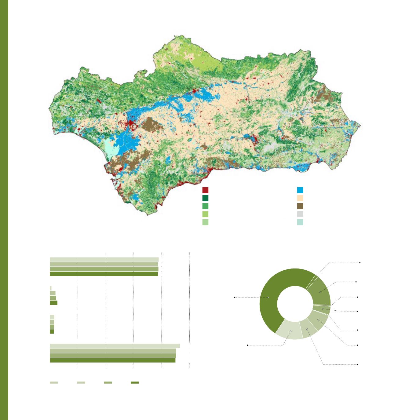
Information obtained
from the vegetation
landcover map of 2007
Areas scarce in vegetation
Heterogeneous agricultural areas
Non irrigated areas
Irrigated areas
Shrubland and Herbaceous formations without trees
Grasslands with trees
Scrublands with trees
Dense tree formations
Constructed and Altered Areas
Wetlands and water areas
Vegetation landcover map *
Natural Resources
50.1 %
Urban and
residential areas
1.3 %
landfils anddumps
2,632.6 km
2
(3%)
13 %
Industrial services areas
14.5 %
Areas under
construction
0.5 %
Port areas
3.8 %
Green and
recreational areas
0.5 %
Airports
8.5 %
Altered areas by
extractive activities
7.6 %
Altered areas by
communication ways
Constructed and Altered Areas *
Landcover evolution in Andalusia *
Agricultural areas
0
1,000
2,000
3,000
4,000
5,000 **
1999
1956
2003
2007
3,891.6
3,870.6
3,865.9
3,882.1
51.3
195.3
263.3
219.0
153.8
143.1
137.9
146.4
4,656.4
4,549.8
4,491.8
4,511.4
Natural and forest areas
Water and wetlands areas
Constructed and altered areas
**
Thousands of hectares
10
Vegetation and land use


