


Sierras Subbéticas Geopark Map
Sierras Subbéticas was declared Natural Park in 1988. Since 2006, it forms also part of the European and Global Geoparks Networks. After the declaration of the International Program of Geological Sciences and Geoparks, in 2015, Global Geoparks were renamed to Unesco Global Geoparks.
The protected area within the Sierras Subbéticas Natural Park is also a Special Area of Conservation (SAC) and Special Protection Area (SPA). Into the Natural Park, we will find the Cueva de los Murciélagos Natural Monument, in Zuheros.
Since 2008, the Natural Park was included into the European Charter for Sustainable Tourism (ECTS).
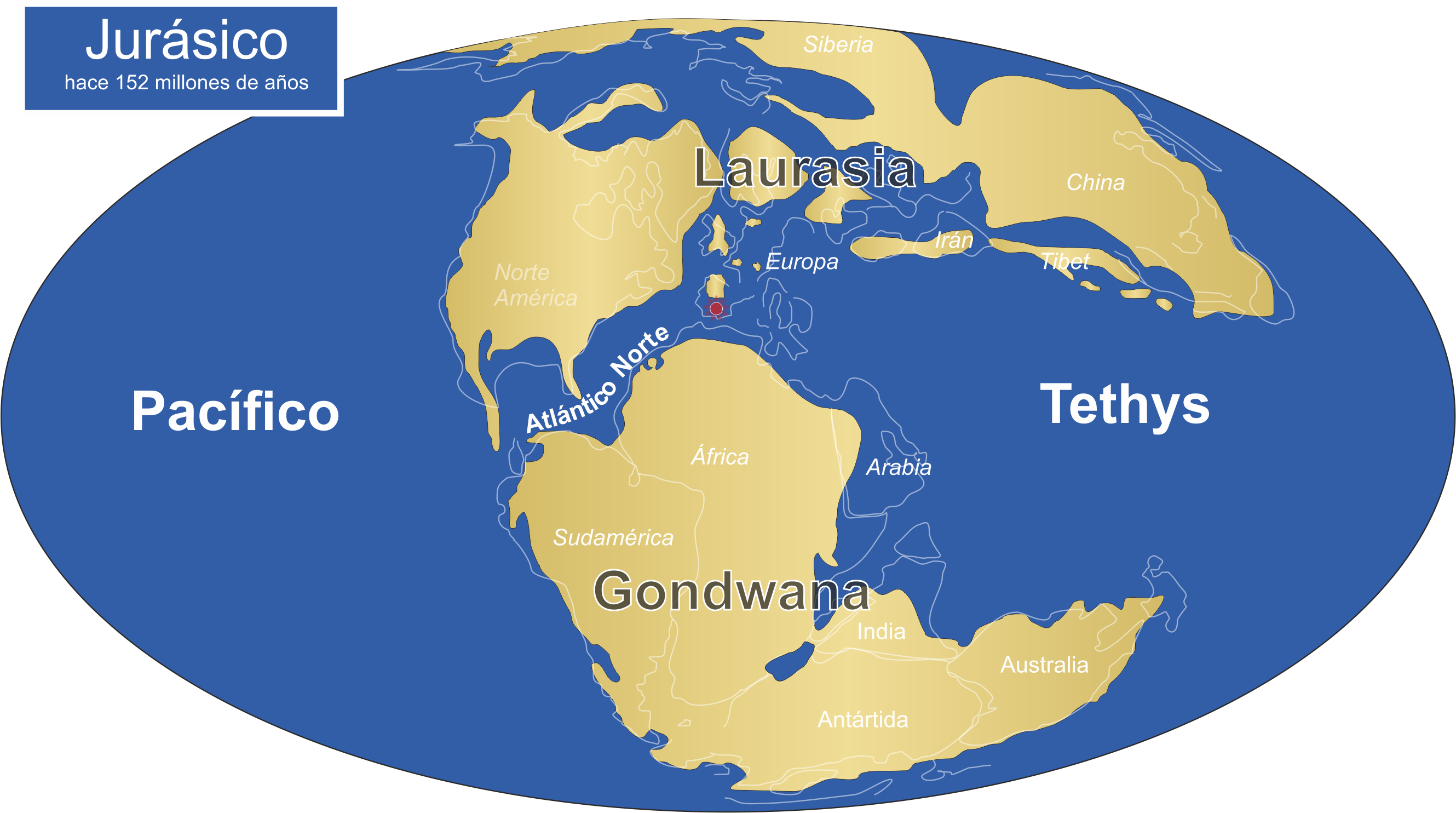
This Geopark constitutes an exceptional example of the External Subbetic Zones of the Betic Cordillera. It contains rock deposited in a marine platform to the south of Sierra Morena (Variscan Domain) during the Mesozoic. Therefore, the rocks of Sierras Subbéticas can provide information about the complex evolution of the Tethys ocean since the last 250 ma. This encompasses phenomena like fluctuation of the water column, advance and retreat of the coastline, evolution of fossils organisms, etc.
During the Miocene (20-10 ma ago), the collision between Africa and Iberia caused the uplift of the Betic Cordillera. The rocks deposited as sediment in the seabed during the Mesozoic conform nowadays the mountains and valleys of the Geopark. Recent erosive processes have modelled an impressive karst landscape.


- Address:
C/ Santo Tomás de Aquino, s/n (14.071-Córdoba)
Telephone: 957 734 106
- Santa Rita Visitor Centre:
Ctra. A-339 Cabra-Priego km 11.2, Cabra (Córdoba)
Telephone: 957 506 986